I pride myself on knowing my way around the Hamptons but I must admit the place I am least comfortable driving around is in the Northwest Woods/Northwest Harbor hamlet of East Hampton. For some reason while driving to or from this part of the Hamptons I feel like I am in Maine. The huge pines, and the shade of most roads there feels very “un-Hamptons” and quite frankly non East End. Sometimes I feel like Northwest Road and Old Northwest Road along with Cedar Point Road are very confusing in daylight and at night practically impossible. To top it off because of sketchy cell service my GPS is useless in the area, so many times I am using my compass and maps just like in 1986 the first time I remember being lost back there after dropping off a friend at his home.
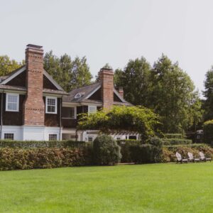
There is history of Northwest Harbor hamlet in East Hampton Town with 3317 residents (2010 census). it takes up 16.1 sq. miles of which 1.6 sq. miles is water. Believe it or not Northwest Harbor was the first port of East Hampton Whaling (predating Sag Harbor), dating back to the late 1600’s. There are still a few very old homes and properties tucked away under some giant pines.
I love to sail around Cedar Point and view the Northwest Harbor via a body of water known as the Barcelona Bank. I love thinking back to the 1648 original settlers and wonder what they thought of the tall sandy bluffs and deep wooded views. Back in those days Sag Harbor was a huge Indian village still inhabited by Indians. Sag Harbor was first settled by the Algonquin Indians who called their village Weg-wag-onuch which legend has it comes from the Indian words meaning “land at the end of the hill.” The English (Southampton Trustees) didn’t purchase the property from the Indians until 1707.
When I lived in the Springs pre-smart phone and GPS, riding my road bike in that area was fun because Ben Dollinger, an East Hampton High School grad and now actually running for Town Trustee, would lead me through the area and even he would get us lost but usually not for long. I now have some friends who live back there in the Northwest Woods, which is actually another name for Northwest Harbor. Now even almost 20 years of visiting them on any given night I still can and do get lost.
Sailing there is a pleasure and is quite easy. Sometimes I anchor off Cedar Island Lighthouse. Why is it called Cedar Island Lighthouse? Because when it was first built in 1839 it was actually situated on an island between Gardiner’s Bay and Northwest Harbor and the Barcelona Banks, however the Hurricane of 1938 filled in the space between the island and what is now called Cedar Point. For the last 15 years there have been efforts to restore the Lighthouse, but so far it has been political photo ops, newspaper stories and no real action.
There are a few wonderful beaches such as at the end of Alewife Brook Road with parking. This beach is off the beaten path so it is usually quite quiet, even during high season. I sometimes throw my anchor in the shallow water and jump in the clear, clean beautiful water on hot days if the wind dies down.
There is a pretty good chance you may have never even visited this area ever. It’s fun to explore, but bring a map and a compass. I strongly suggest a nice fall bike ride when it’s cool, but not cold and the leaves are turning colors. However, don’t get lost back there!
Sixty-Something: Northwest Harbor, A Beautiful Hamptons Secret
STAY UPDATED
TRENDING
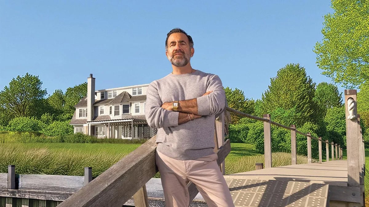
In Contract in 15 Days: Rod Cummings’ Keys to Success
When I saw Rod Cummings listed 112 Meeting House in Westhampton Beach two weeks ago, I was excited to write about the property and had already logged 758 words about the .69-acre property. I should have remembered that the exclusive listing agent was Rod Cummings. Rod sold a property this winter despite the combined 50’’ of snowfall, and it’s officially summer in the Hamptons now – so it’s no surprise that he put 112 Meeting House in contract faster than I could publish my article about it.
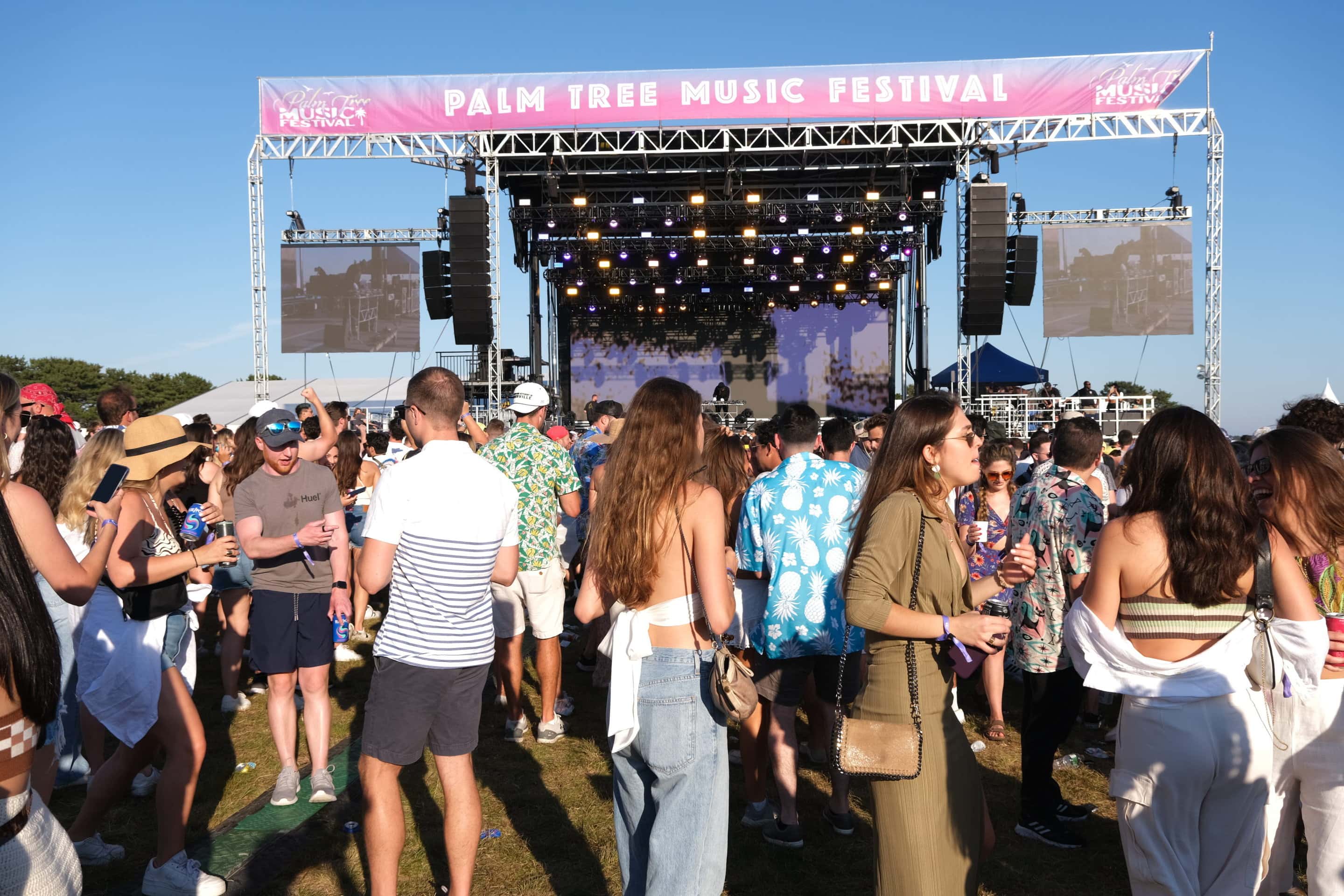
Top 10 Hamptons Events This Weekend
Check out the top Hamptons events this weekend! From the Palm Tree Music Festival to Fetty Wap, which event are you excited for?
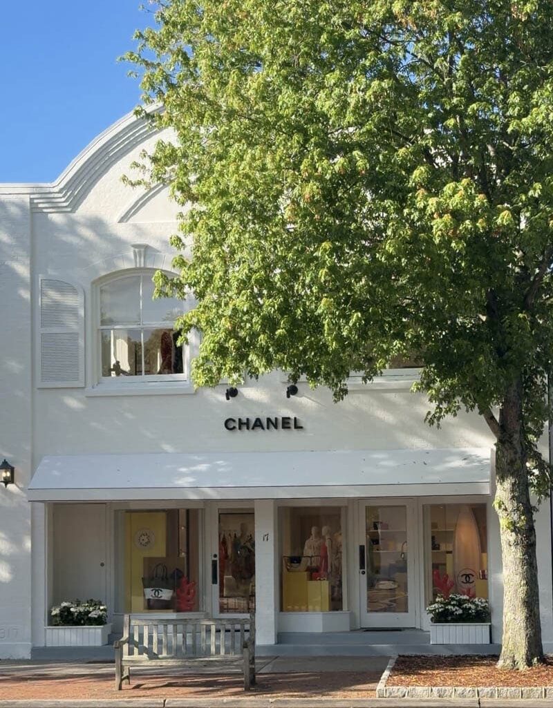
East Hampton Luxury Shopping Guide
Where coastal elegance meets high fashion. East Hampton continues to attract some of the world’s most coveted brands, transforming its charming streets into a summer destination for luxury shopping. From Chanel, Prada, and Louis Vuitton to Brunello Cucinelli, Loro Piana, Loewe, and Ralph Lauren, Main Street and Newtown Lane are lined with iconic fashion houses that blend coastal charm with world-class style.
![Sculpture @ Sylvester Manor: [R]evolution](https://hamptons.com/wp-content/uploads/event-manager-uploads/event_banner/2021/07/manor_house-350x350.jpg)


.
.
.
#hamptons #usopen #shinnecockhills #wolffer #golf")

Saunders Broadcasting Corp.
Phone: 631-613-8440
Email: [email protected]
Facebook: Facebook.com/HamptonsOnline
Twitter: @Hamptons
Instagram: @HamptonsOnline
About Us | Contact Us